Google in reverse allows us to move forward
 We’ve gone around the horn with the National River Cleanup Week registration process trying to find the most effective one-two combination and I think we’re on to something…a Google map in reverse.
Our challenge has been potentially plotting multiple 2007 cleanups on one river and all within the same zip code too. It's not too accurate and we definitely didn’t want to ask for the cleanup longitude and latitude, so we were stuck with finding the easiest and most precise way to capture an exact data point (2007 river cleanups) for the map.
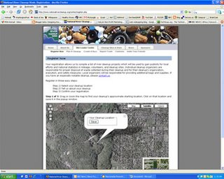
The draft to date contains a blank map of the US and once an organizer decides he/she is ready to register, they go to the map and zoom in to the exact location and register—very cool.
I zoomed in (photo above) to my home in DC, then moved north a bit, and found the section of Rock Creek in Rock Creek Park that I wanted to organize a cleanup around and clicked ‘Save’. My coordinates were saved and I was then routed to a registration page that asked for additional, but necessary information. After that I got an email to confirm my registration (crucial authorization step) and then it’s up to me to recruit my cleanup volunteers, if I haven't done that already.
This seems to work very well and I really like that this gives the traditionally boring online registration process a little excitement and interaction.


No comments:
Post a Comment